Archaeological surveys confirm the Nazca Lines represent a significant pre-Columbian cultural achievement requiring advanced surveying techniques. The site demonstrates sophisticated understanding of geometry and astronomy by indigenous Nazca civilization. UNESCO designation as World Heritage Site recognizes cultural importance while ongoing research continues mapping extent of geoglyphs. Current evidence supports ceremonial and astronomical functions consistent with known Andean cultural practices of the period.
CASE FILEMysteryUncertain
The Nazca Lines: Ancient Runway or Celestial Calendar?
Case Summary
Massive geoglyphs in Peru's desert visible only from sky. Created 2,000 years ago by vanished civilization.
Official Narrative
Evidence Archive
4 items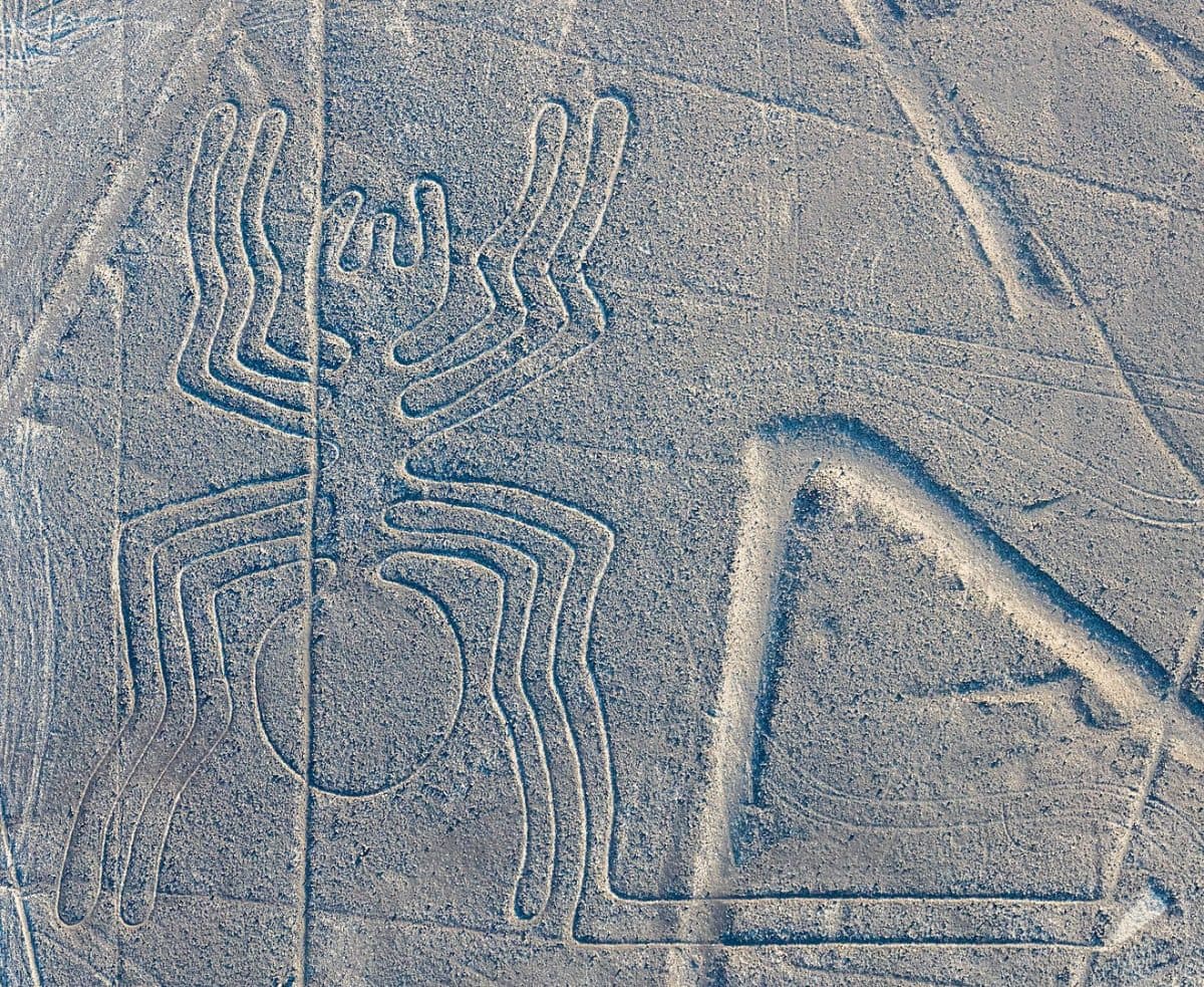
Photograph
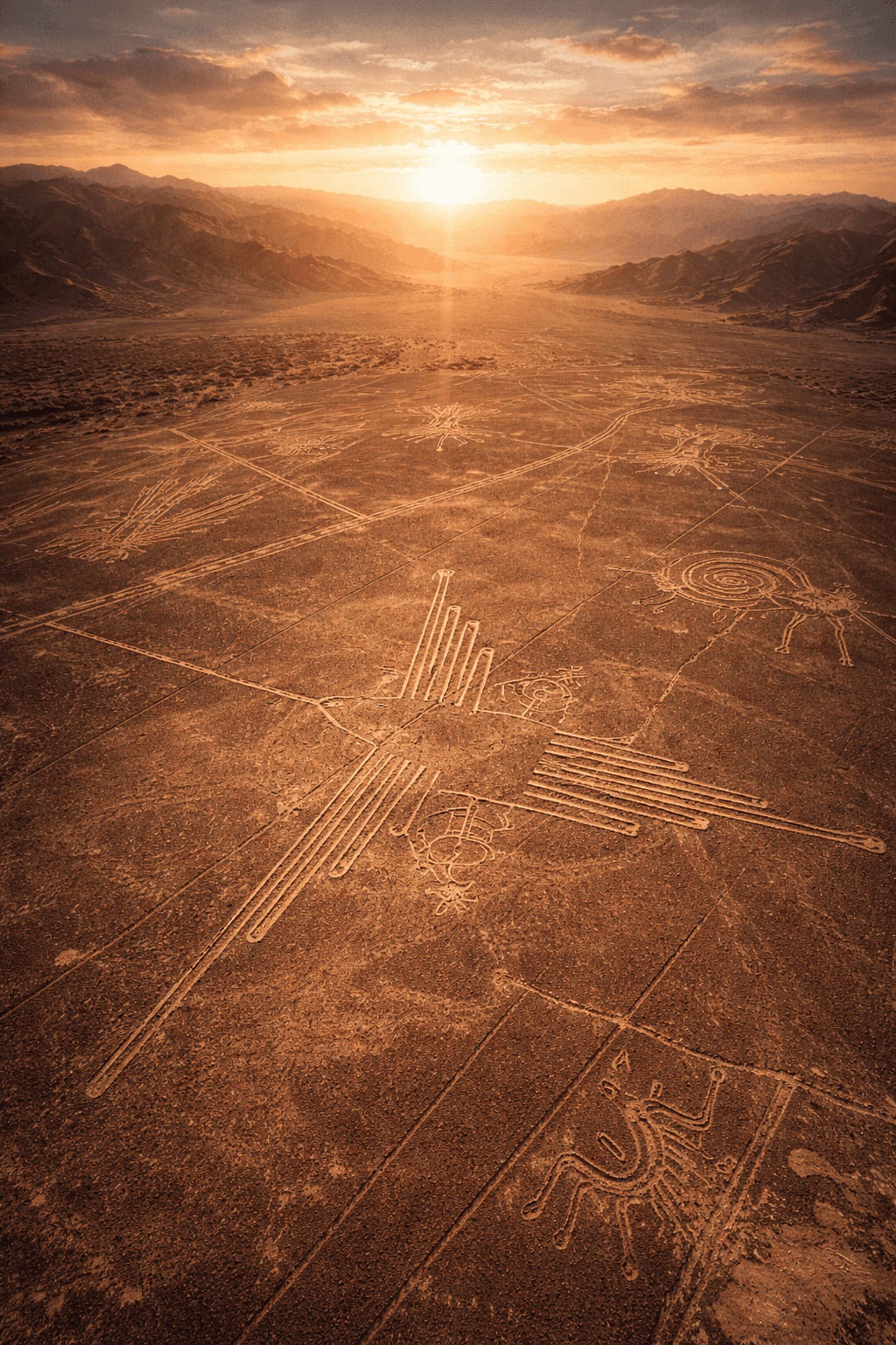
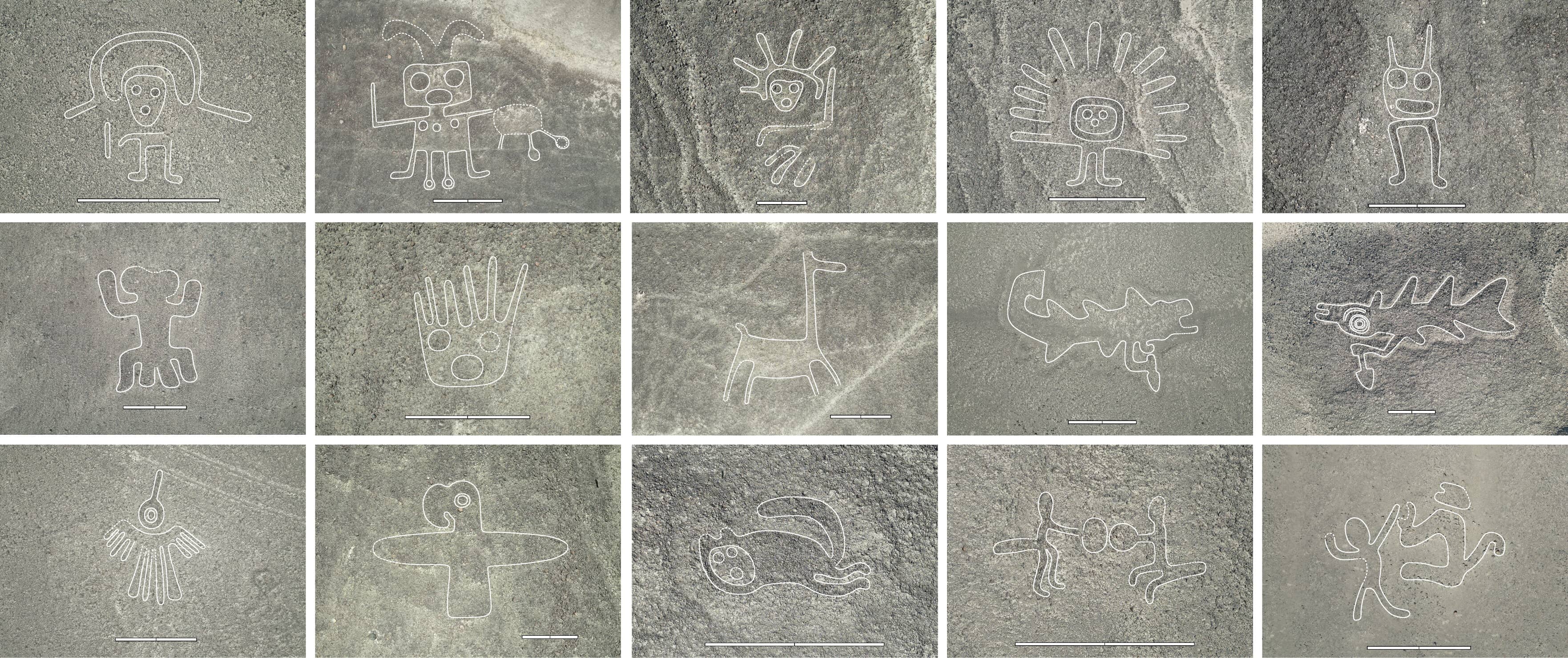
Aerial Survey Documentation and Mapping
Paul Kosok, a historian from Long Island University, first photographed the lines from aircraft in 1927 and 1939, documenting their true scope and precision. German mathematician Maria Reiche spent over 50 years methodically mapping the lines, creating detailed surveys and photographs that revealed the mathematical precision of the constructions. Her work from 1946-1998 established the first comprehensive catalog of the geoglyphs. Kosok's aerial photographs revealed that many lines are perfectly straight for miles, deviating less than 2 meters per kilometer. Reiche's ground surveys confirmed that the animal figures maintain perfect proportions when viewed from specific altitudes between 500-1,500 feet. The spider geoglyph measures 46 meters long with anatomically correct proportions visible only from above. Modern GPS surveys have confirmed Reiche's measurements with millimeter accuracy. Reiche's complete photographic documentation was published in *Mystery on the Desert* (1949, revised 1968) and remains the definitive visual record. Her original survey notes and photographs are housed at the Maria Reiche Centre in Nazca. Why would ancient people create massive artworks with such precision that require aircraft to appreciate?
Archaeological Dating and Construction Analysis
Experimental Balloon Flight Documentation
Theories & Analysis
5 theories1
Ancient Astronaut Landing Strips
Source: Erich von Däniken2
Astronomical Calendar System
Source: Maria Reiche / Gerald Hawkins3
Sacred Water Ceremony Pathways
Source: Johan Reinhard4
Ancient Hot Air Balloon Navigation
Source: Jim Woodman5
Advanced Lost Civilization Technology
Source: Alternative Archaeology CommunityEyewitness Accounts
4 reportsP
Paul Kosok
M
Maria Reiche
G
Giuseppe Orefici
M
Masato Sakai
Investigation Verdict
The Nazca Lines are undeniably real and represent remarkable ancient engineering. However, their true purpose remains hotly debated. While astronomical alignments suggest a ceremonial calendar function, the aerial perspective requirement raises uncomfortable questions about ancient capabilities. The precision and scale exceed what should be possible with known Nazca technology. Recent discoveries of new lines using satellite imagery prove we're still uncovering their full extent. Whether they're sacred pathways, star maps, or something else entirely - the mystery endures.
Related Case Files
Connected Cases
Historical
Uncertain
The Göbekli Tepe Enigma: 12,000-Year-Old Civilization That Shouldn't Exist
Massive temple complex predating Stonehenge by 6,000 years challenges everything we know about early human civilization.
Historical
Uncertain
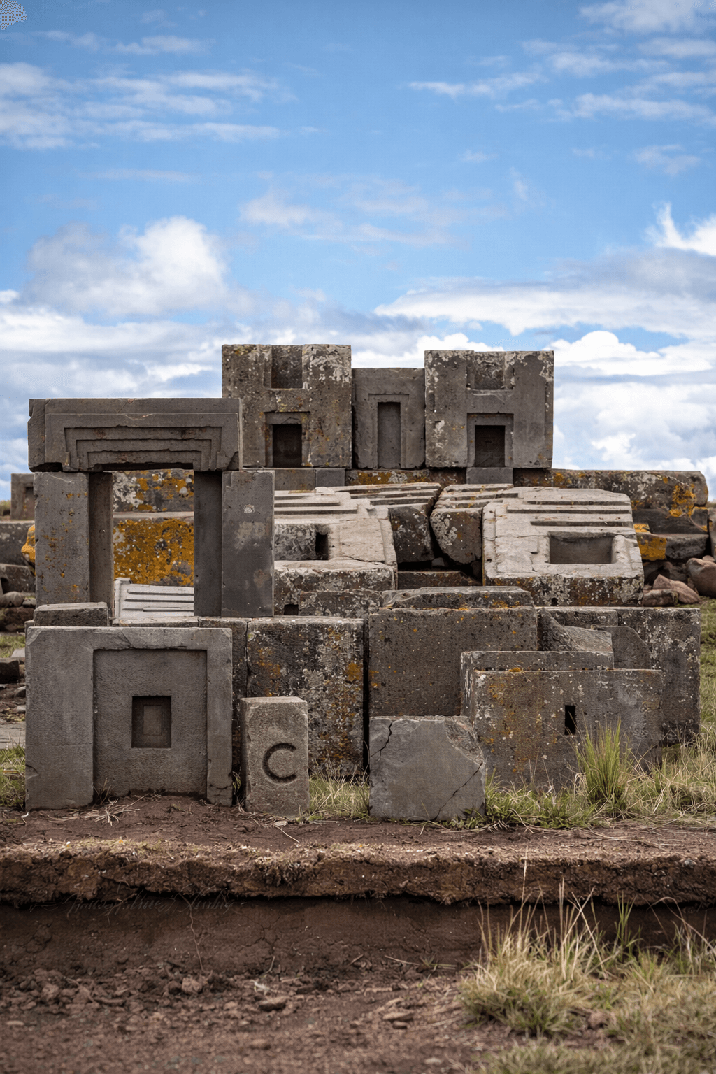
The Impossible Architecture of Puma Punku
Ancient Bolivian site features stone blocks cut with impossible precision. H-shaped interlocking joints suggest advanced technology predating known civilizations by thousands of years.

Historical
Uncertain
The Lost Civilization: Modern Search for Atlantis
Recent scientific expeditions have identified multiple candidate locations for Plato's lost city, from the Mediterranean to Antarctica.
More Mystery Cases
Mystery
Uncertain
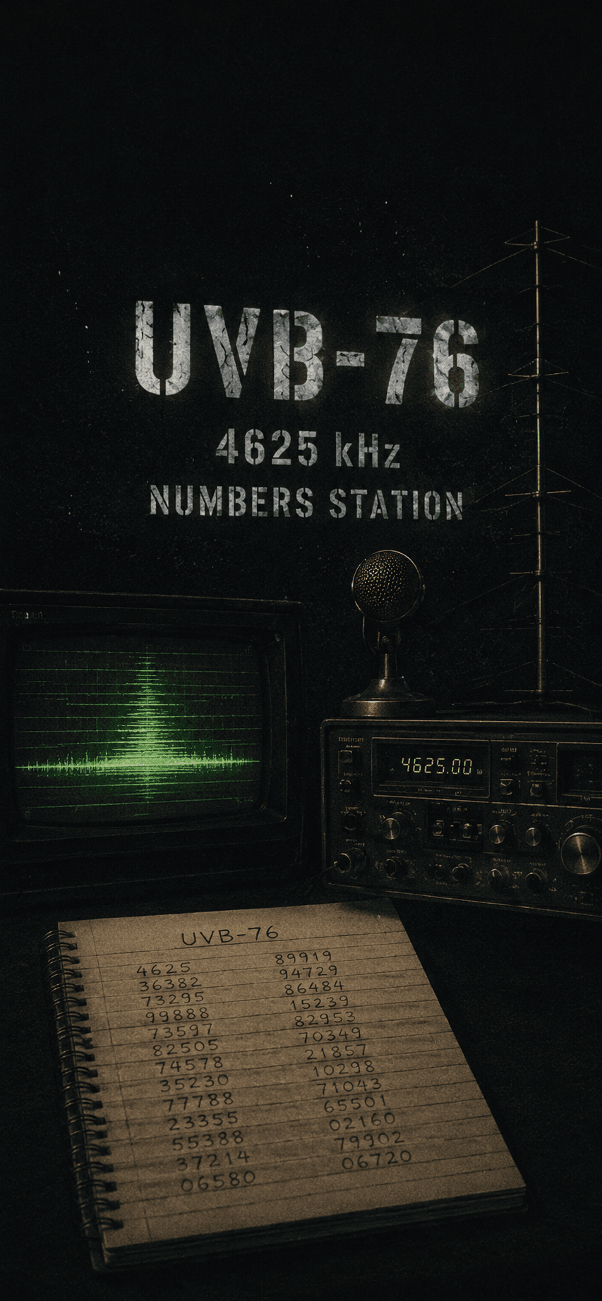
The Buzzer: Russia's Mysterious UVB-76 Signal
A Russian shortwave radio station broadcasts mysterious buzzing sounds and coded messages 24/7 since the 1970s. Military installations, spy communications, or something else entirely?
Mystery
Uncertain
Boy in the Box
Unidentified child found brutally murdered in Philadelphia's Fox Chase neighborhood. Despite decades of investigation, his identity remains unknown.

Mystery
Plausible
Spontaneous Human Combustion
People burning to ash from within while surroundings remain untouched. Over 200 documented cases challenge conventional understanding of fire science.
Also in South America
UFO
Plausible
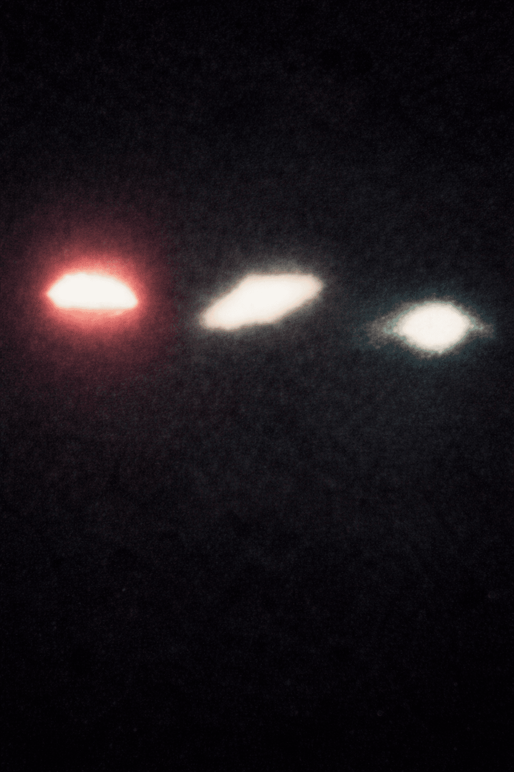
Operation Prato: Brazil's Official UFO Investigation
Brazilian Air Force's classified investigation into UFO attacks on civilians in Colares. Military documented beam injuries and mysterious deaths.

UFO
Uncertain
The Varginha Incident: Brazil's Roswell
Multiple alien beings allegedly captured after UFO crash in Brazilian city. Military and fire department reportedly retrieved bodies.